Indian Flat to Railroad Flat
_____________________
Length: 16 miles / 1 day
Class: IV (IV-V above 5000 cfs)
Gradient: 40 ft/mile
Permits: none
Season: Spring and Summer runoff
Recommended Flows: 1000 to 12000 cfs below Briceburg
Shuttle: 45 minutes/ 16 miles
Merced River Rafting and Kayaking Overview
The Merced River is a classic California Sierra foothill rafting and kayaking run. At low flows there is a nice class II section from the old suspension bridge to Briceburg. Upstream is some fun class 4 in the Red Bud section. The higher one drives up the canyon the more challenging the whitewater becomes. While a float through Yosemite Valley is spectacular, those looking for whitewater prefer this run which puts-in 30 minutes downstream from the Highway 140 park entrance. It is also makes an excellent additional to rafting the Tuolumne.
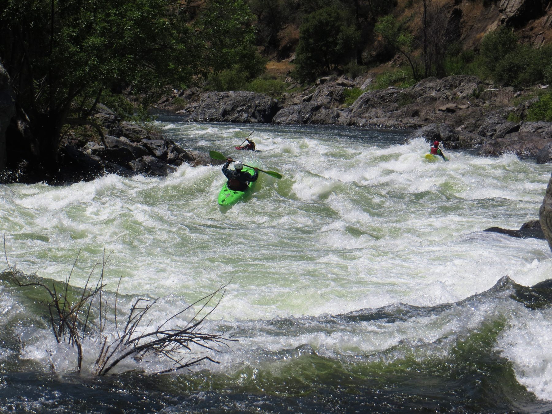
At high water the Merced has fantastic wave trains and also a potential for long swims due to the limited eddies and consistent gradient in the upper section of the run. Flipped boats have traveled over 5 miles downstream before they were pulled to shore. At high water Split Rock is an astounding rapid.
Merced River Rafting Video
Outfitter Spotlight
Sierra Mac River Trips
First rafting outfitter on Yosemite’s Tuolumne & Merced Rivers & pioneer on the Cherry Creek/Upper Tuolumne. Family run, locally based, mature guides, Tuolumne River specialists for over 50 years! Call us: (209) 591-8027
Highlights
Mile 0: Put-in
Put-in at the Forest Service Indian Flat Day Use Area. As of 2019 there is a $10 day use fee, it is not clear if it is per person, per vehicle or per boat. There are bathrooms and a nice paved parking. There isn’t much of a warm-up as current takes boaters directly into Cranberry Gulch Rapid, one of the hardest rapids on the run. At high water this river is fun but requires strong skills as the sides of the river are filled with strainers and there are no pools and minimal eddies.
Above here are more fun rapids. People typically put-in at Red Bud but can go further up to the Highway 140 Bridge. The section above is best at flows below 2000 cfs.
Mile 0.3: Cranberry Gulch Rapid (IV)
This rapid has some boat flipping holes. There is a good scout by walking down Highway 140 on river left. Below here the river is fairly continuous.
Mile 2.8: South Fork of the Merced River
The South Fork of the Merced River increases the flow of the Merced by about a 1/3. There is a Class V+ run on the South Fork starting in Wawona and a shorter 5 to 7 mile section of Class IV that ends here at the bridge.
Mile 3.5: Bridge
After crossing under a bridge the river turns to the right at Balls to the Wall and picks up a little speed in the corridor down to Ned’s Gulch.
Mile 4.5: Ned’s Gulch (IV)
The canyon narrows causing many large waves as the river turns to the left. There is a nice eddy on the right above the rapid to scout.
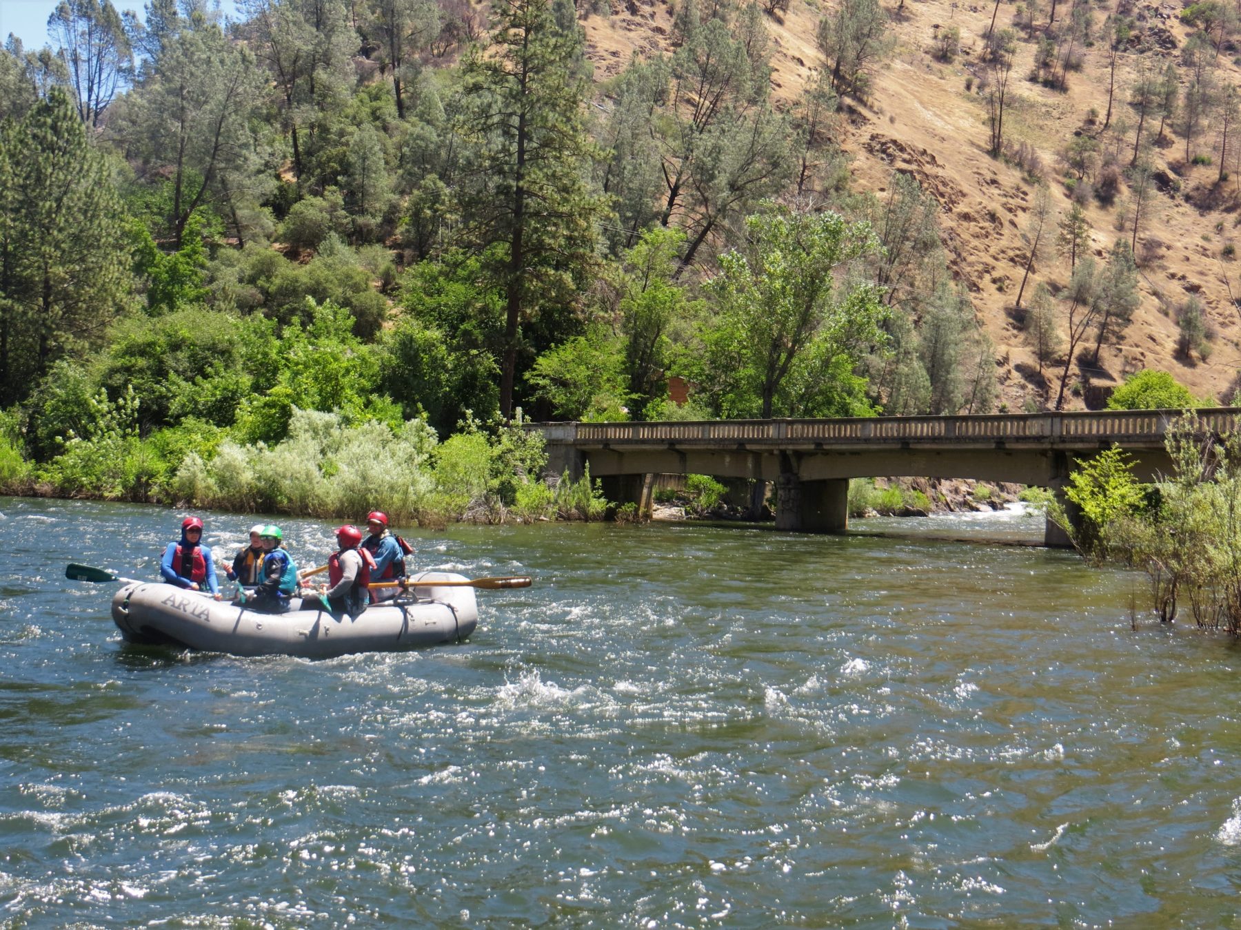
Mile 5.9: Suspension Bridge, Miller Gulch
This is a common river access for people wanting to have a low water class II+ run down to Briceburg.
Mile 11.9: Briceburg
Highway 140 leaves the river here. This is a nice access point to put-in or take out.
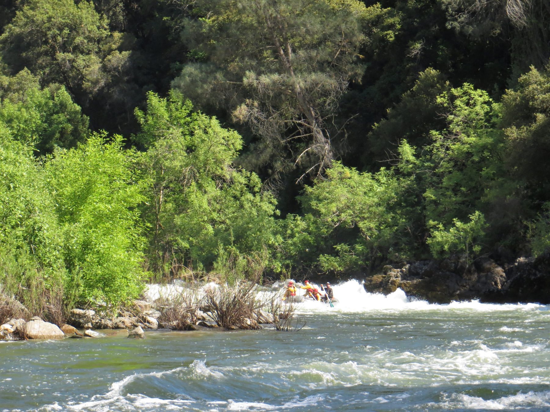
Mile 13.4: Bikini Ledge (III)
After going under the bridge at Briceburg, the river goes down a long calm straight away. Below here the river picks up. On the second bend to the left is Bikini Ledge, a river wide that is typically missed by running left. Below Bikini Ledge the river enters a continuous gorge down to Split Rock.
Mile 14.2: Split Rock (IV+)
Towards the end of the gorge there is a obvious horizon line. At high water Split Rock is one of the best rapids in the west and by by far the most exciting part of a Merced River rafting trip. Enter on the left and work left to avoid the big feature at the bottom of the rapid. Eddy out quickly as Corner Pocket is just downstream.
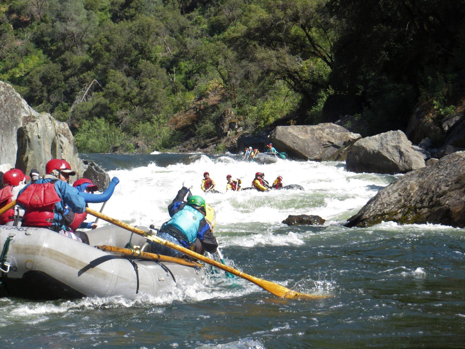
Mile 14.3: Corner Pocket (IV)
At low water Split Rock gets easier and Corner Pocket gets much more violent trying to slam boats into rocks on the bottom left.
Mile 14.4: McCabe Flat Campground
This is a nice place to camp and end your river trip. The next 1.6 miles is pretty mellow down to the commercial take-out.
Mile 16: Take-out above Railroad Flat
Just above a riffle the take-out is on river right as the road comes close to the river. Below take-out are some fun class IV rapids including Quarter Mile Rapid and a portage at North Fork Falls. The problem with the lower run is the paddle across the lake at Bagby. After a couple of drought years the lake can get low enough that there is current all the way to the bridge.
If you are looking for other runs in the area check out rafting in Yosemite and on the Tuolumne River outside the park. There are four excellent outfitters that run the Tuolumne.