Buchanan Road to Wards Ferry Bridge
__________________
Length: 12 miles (plus 3 miles on the Main Tuolumne) / 1 day
Class: V (3+ portages)
Gradient: 100 ft/mile
Season: Spring runoff
Shuttle: 35 minutes/ 13 miles
Permits: none
Recommended Flows: 400 to 700 cfs at confluence with main Tuolumne
Flow Information: dreamflows estimate or eyeball at the confluence with the main Tuolumne
North Fork Tuolumne Rafting and Kayaking Overview
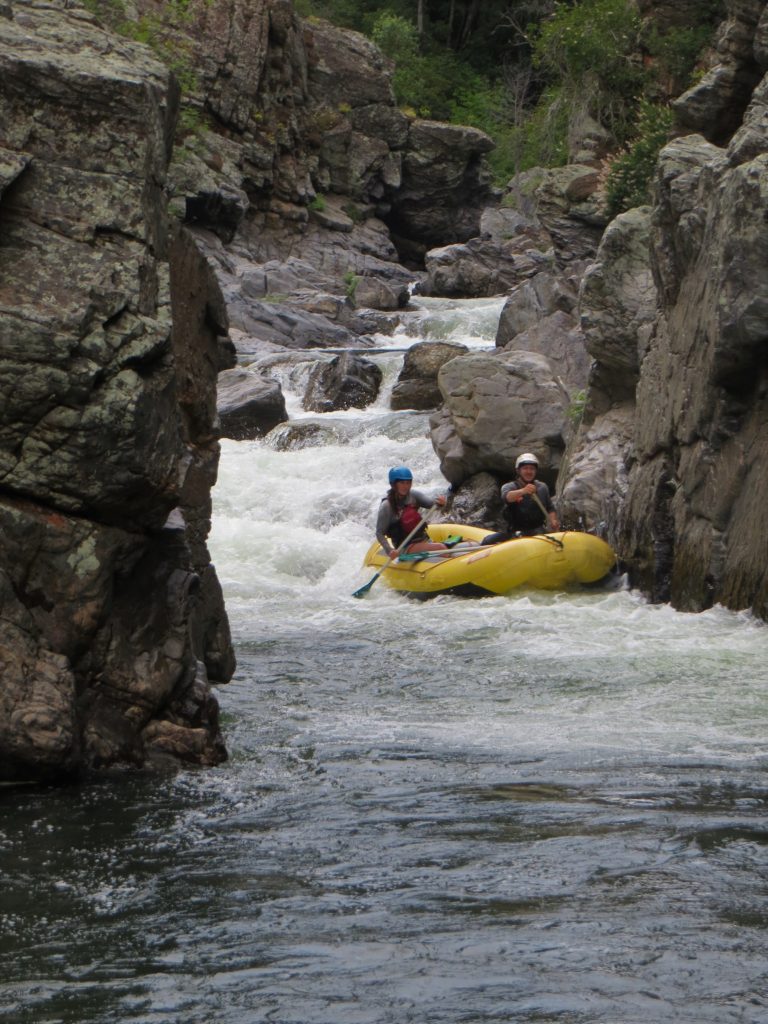
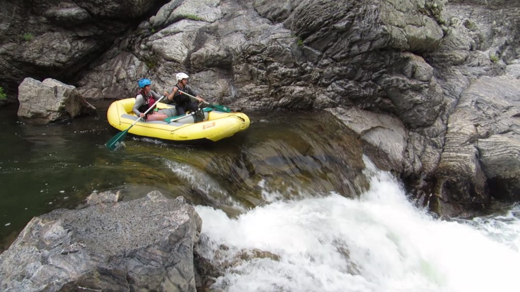
The North Fork of the Tuolumne is a seldom run classic, well worth the long day of rafting or kayaking. Numerous fun, nice size drops are throughout the run. The trip is a major commitment for only being 15 miles. Our last run was an 8.5 hour affair with only two short breaks to snack and pump some water. There were a fair number of portages with a couple being pretty strenuous. Small rafts were ideal and could be lined for almost all the portages. Between the gorges are brushy rapids that will make you glad you have a helmet.

Highlights
Mile 0: Put-in
Put-in at the Forest Service Riverside Day Use Area on Buchanan Road. There are bathrooms and a nice paved path down to the put-in. be aware of a weir that can be avoided by launching a little farther downstream. Below here the river is brushy and rocky like much of the river. After claw through brush and banging on rocks for about a half mile that will take 30+ minutes the river starts to open up a bit.
Mile 0.5: Granite Falls (V+)
This rapid is commonly portaged by lining or walking on river right.


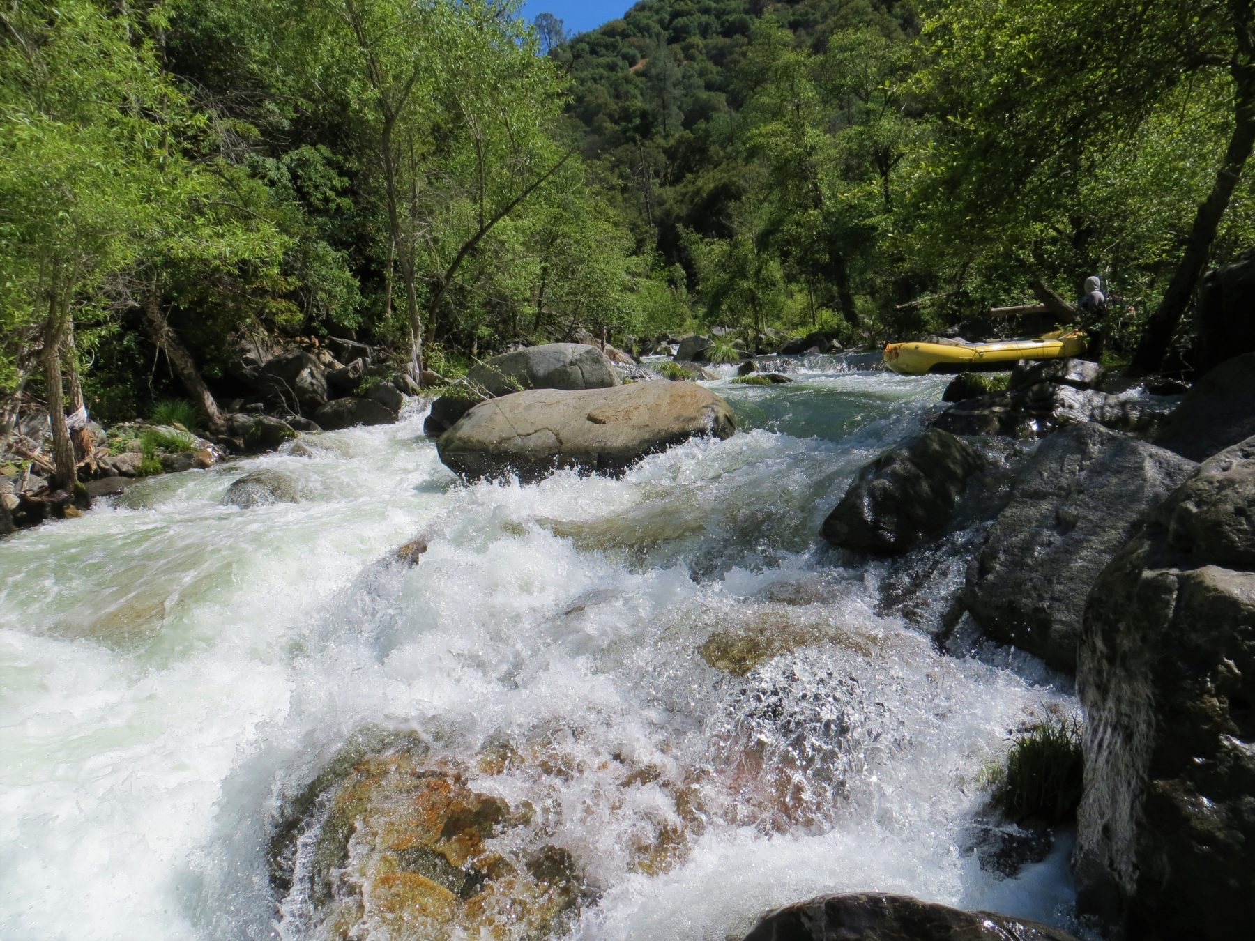
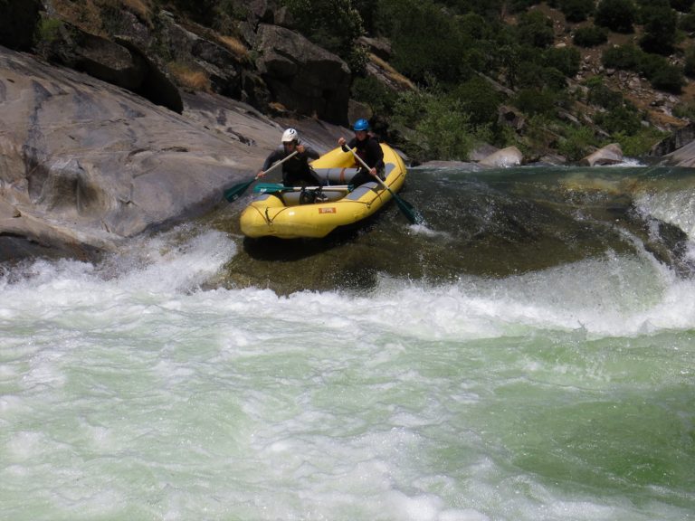
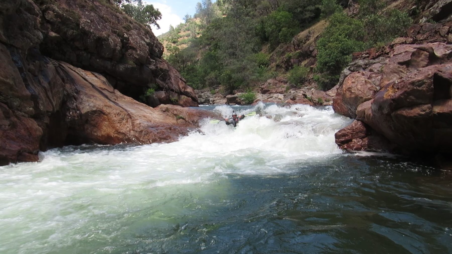
Mile .5 to 2: Ledges and Slides (III-IV)
There are multiple fun ledges and slides below the falls. Enjoy them because more hardship awaits shortly.
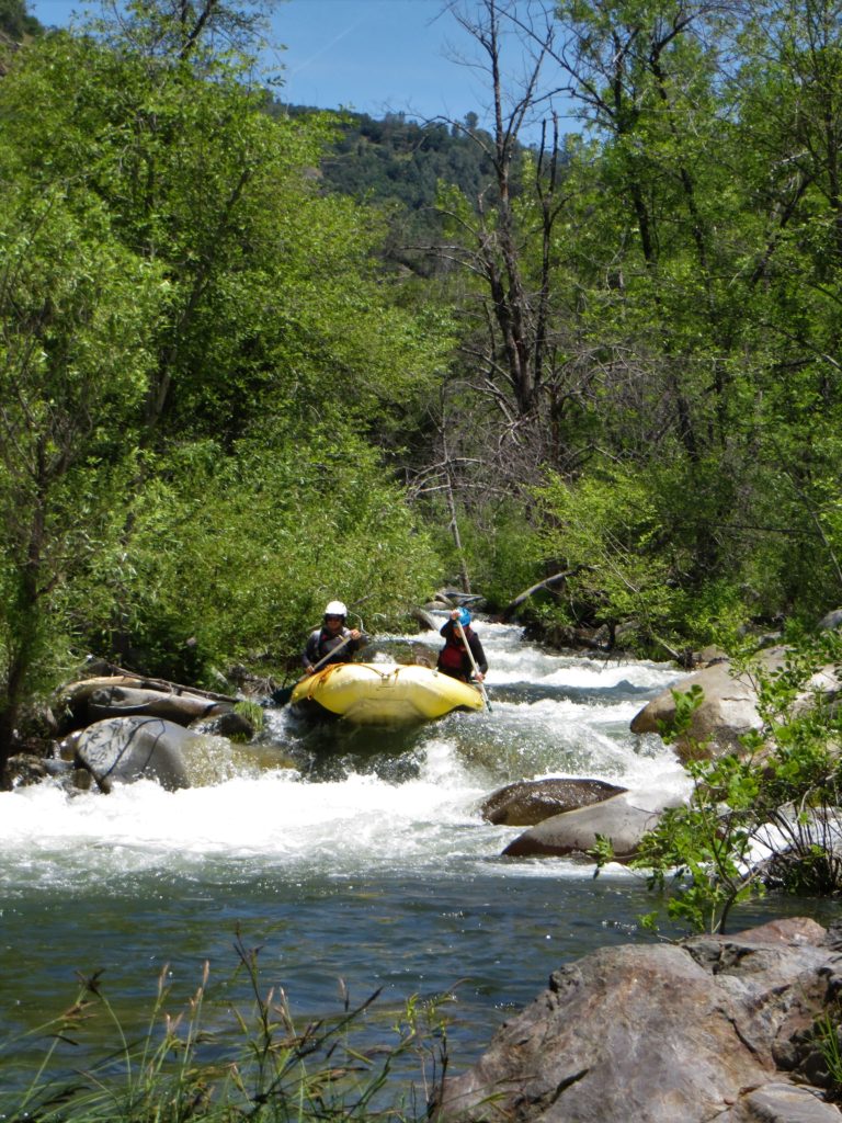
Mile 2 – 5: Brushy and Rocky (III-IV)
Lots of brushy rapids. Look for a little tunnel chute where most of the water flows underneath two rocks laying against each other. Just below here is another big rapid. Towards the end of this section there are some homes built along the river.
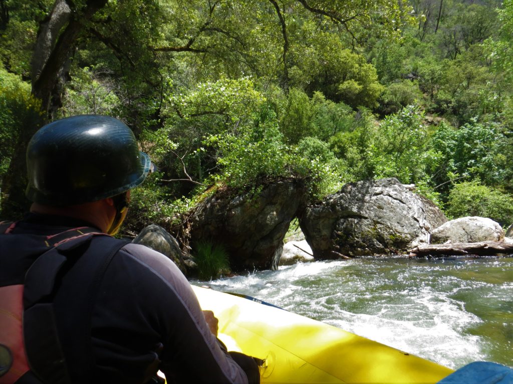
Mile 5: Steep and Junky (V)
The canyon has left the granite and moved into schist. This large drop can be scout, lined, and portaged on the right. Downstream is another fun gorge.
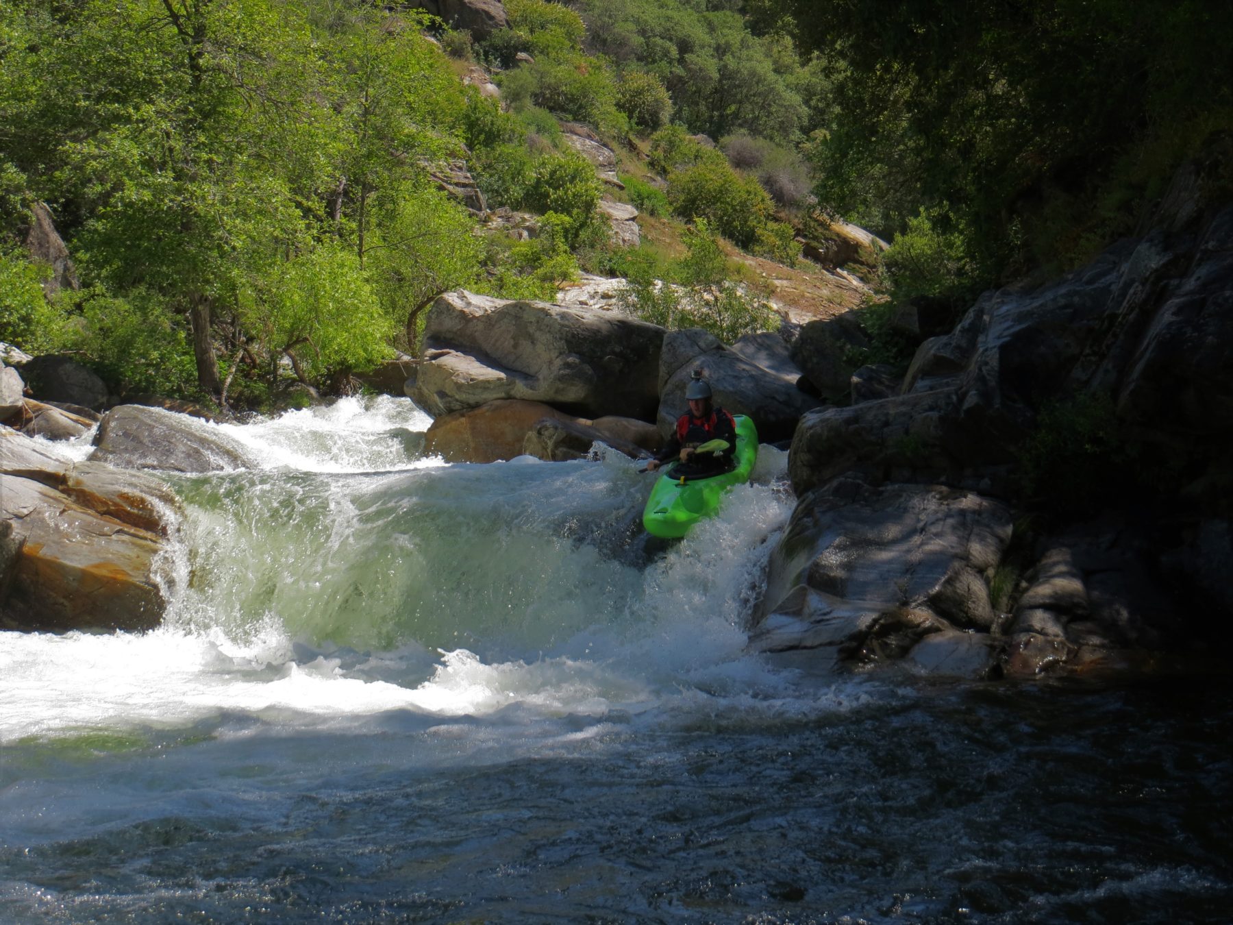
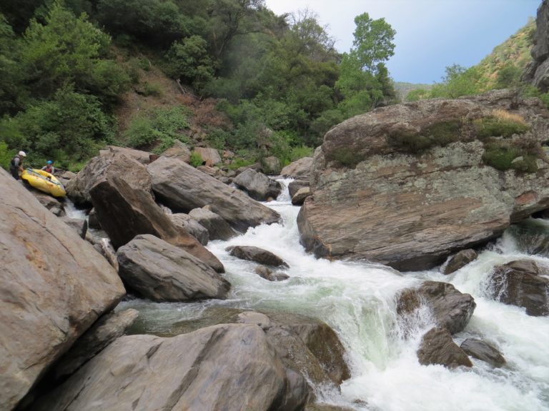
Mile 5.0-6.0: Gorge IV
More fun rapids and easy miles in this section
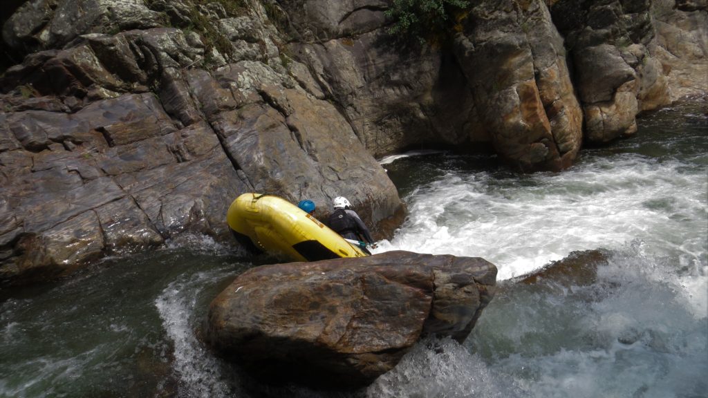
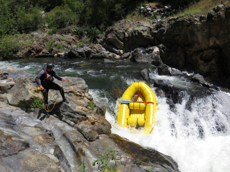
Mile 6.5: Hunter Creek Falls (V – Portage)
Hunter Creek is a major drainage cascading in on river left. The run is in the left chute. There is a nice portage route on river right and the rapid can be lined easily on river right.
Mile 8: The Waterfall (V)
A fifteen foot drop into a nice pool, the waterfall is typically run on river right. Portaging and lining is best on river left.
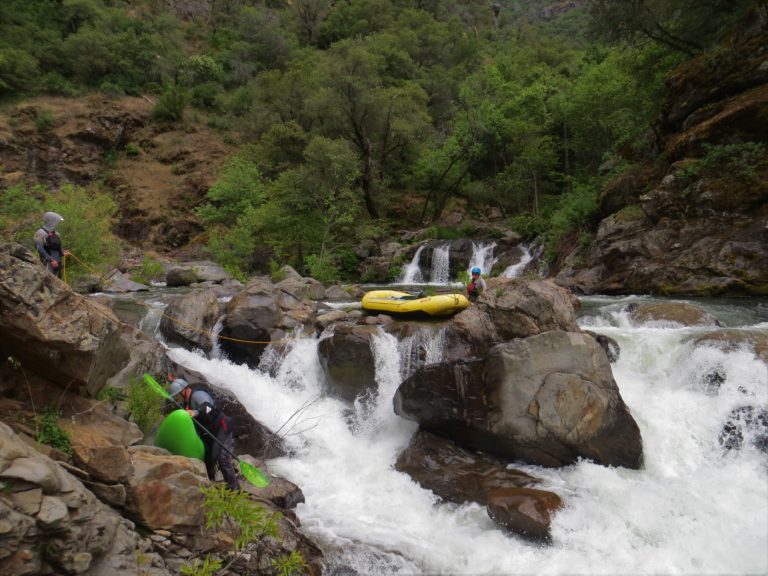
Mile 9: Big Portage (VI)
It is easiest to line and carry your raft on the right side of the river for the first part of portage and then ferry to river left to finish the portage.
Mile 11.2: North Fork Swim Hole (III+)
It looks much different with all the water.
Mile 12: Confluence with Main Tuolumne River
Now it’s time to relax and float out on the end of the Tuolumnne River. Chances are the Tuolumne is running 6 to 10,000 cfs. If the reservoir is low there is more excitement below but still easy miles compared to the North Fork.

Mile 15: Take-out at Ward’s Ferry Bridge
Hopefully it is still light out. The bridge can be a little sketchy after dark.
If you are in the area and the North Fork has water it’s best to get a day running the whole Tuolumne River at highwater and maybe sneaking on the South Fork of the Tuolumne.