Jarbidge Forks to Hot Spring Road
_____________________
Length: 70 miles (29 Jarbidge + 40 Bruneau), Usually 3 to 5 days
Class: III-IV (Portage V+ Rapid)
Gradient: 45 ft/mile Jarbidge, 25 ft/mile Bruneau
Permits: Self-register at Put-in
Season: March to June (depending upon snowpack and craft)
Recommended Flows: 600 to 4000 cfs at near Hot Springs Road
Shuttle: 3 hours/ 71 miles
Flow Information: 7 day forecast forecast, snowpack
River Overview
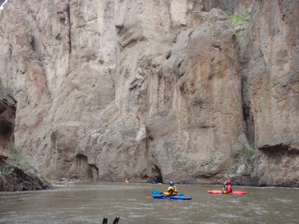
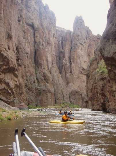
The Jarbidge and Bruneau Rivers make up another of Idaho’s famed list of multi-day rafting and kayaking river trips. While it is possible to run the rivers separately, the nasty high-clearance four-wheel drive requiring road to the confluence of the two rivers makes access challenging (see video below). Add on the fact the entire run has stunning desert scenery makes only doing one of the two rivers a much less desirable option.
Jarbidge-Bruneau Resources
The BLM has some incredible information for running the river be sure to check out the BLM Boating Guide to Jarbidge, Bruneau, and Owyhee – this is the best information on the river. The is also a BLM Map on which you will notice the run on the West Fork Bruneau and on Sheep Creek.
Trip Obstacles
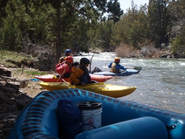
The two main challenges are portage at Class V+ Jarbidge Falls and having enough water. To help with both of these issues the Jarbidge is typically run in kayaks, inflatable kayaks, packrafts, and small rafts (12 ft or less). The Bruneau can be run in larger rafts if they can be delivered to put-in.
Beware for wood a logs particularly on the Jarbidge section. There is also poison and rattlesnakes aplenty!
It can be cold in the high desert in the spring. Drysuits, poogies, warm sleeping bags and tents make for a more comfortable trip.
BLM River Running Rules for the Jarbidge and Bruneau
There are some rules to know about before arriving on your trip. The Idaho invasive species law requires any craft 10 feet or over has to get an invasive species sticker. Groups must be 15 people or less. If you want fires (on one trip we had an appreciated lunch time fire to warm up) you must have a fire pan. You also must have a toilet system, wag bags meet standards. The BLM office in Boise (208-384-3300) can answer questions regarding permits and regulations.
Fishing on the Bruneau and Jarbidge
The most popular fish is the native redband trout which is a subspecies of rainbow trout. On the Jarbidge there is a limit of 2 fish per day. Rainbows and Mountain Whitefish are additional common game fish on the Bruneau where there are no special rules for fishing. Both rivers can be fished year round.
Protection
The 2009 Omnibus Public Land Management Act gave the Jarbidge and Bruneau River and their sister drainage the Owyhee River Wild and Scenic River status. The act also created the the Bruneau-Jarbidge Rivers Wilderness Area which is two pieces of land seperated by the road that accesses the river just downstream from the confluence of the Jarbidge and Bruneau Rivers.
Video of Running the Jarbidge-Bruneau Rivers
Jarbidge and Bruneau Rafting and Kayaking Highlights
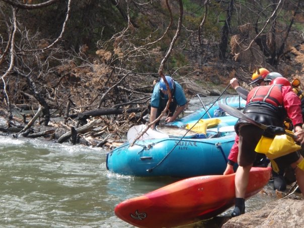
Mile 0: Put-in on Jarbiddge River
Put-in on river right below the bridge where the East Fork Jarbidge meets the main Jarbidge River. There is a pit toilet here and a little boat ramp.
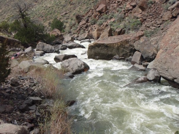
From here down to Sevy Falls at mile 16.5 the river is fun fast class II-III whitewater. The biggest concern in this section is logs and the absence of pools for recovery. Sevy Falls is now partially backed up by Castle Greyskull. Castle Greyskull is changing and Sevy could return to its class IV self in the future.
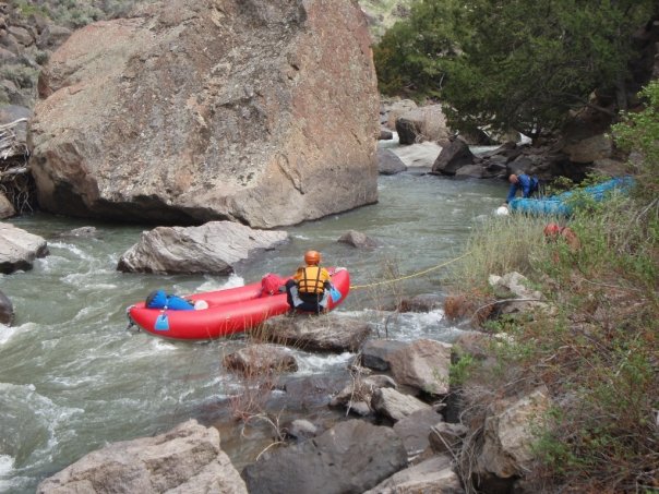
Mile 17: Castle Greyskull (V – Potential Portage)
There is a large slide or river right which backs up the river to form the only substantial pool on the Jarbidge.
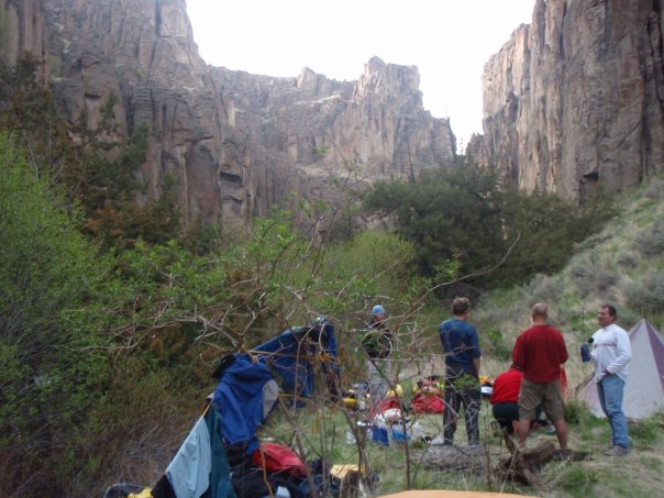
Mile 18: Cougar Creek + Camp Site
Cougar Creek flows in on the left and there is a nice campsite just below the creek. The creek is supposed to have a few mile hike up to some arches.
Mile 21: Wally’s Wallow (IV – Possible Portage)
A large boulder divides the current forcing boater to go right and then cut back behind the rock depending upon the flows.
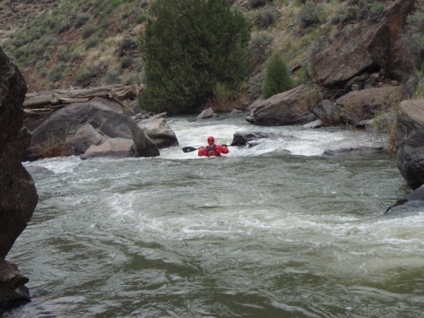
Mile 25: Jarbidge Falls (V+)
Just below the lead-in rapid is a small eddy on river left. get out here and start a fairly grueling carry on a trail down the left shore. Rafters have lined their rafts here depending upon the year and the flows. Its best to get here early in the day as the portage would be a terrible place to camp. At times the portage trail has been over grown with poison oak.
Mile 25: Lower Jarbidge Falls (III-IV)
The bottom part of Jarbidge Falls has a fun drop.
Bruneau River Access
Mile 28.5: Confluence with West Fork Bruneau River
If you are not paying attention you can miss the West Fork Bruneau calmly merging from the left with the Jarbidge River. This is where people sometimes access the river to just run the Bruneau. Upstream on the West Fork Bruneau is a 3 to 5 day class IV-V run for kayakers. Below the confluence the river becomes the Bruneau.
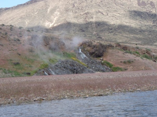
Mile 29: Indian Hot Spring
The hot spring comes in just downstream from the confluence on river left is worth a stop to soak a little and warm up your drysuit. The water is burning hot coming out of the spring.
Mile 30: Cave Rapid (III)
Avoid the undercut cliff on river right that can have wood in it.
Mile 60: Robertson Trail – River Access
River access here on both sides here by trail. People will hike in to do day trips through 5 mile rapid which starts just downstream.
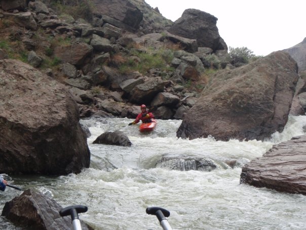
Mile 62: Boneyard Rapid and the start of 5 mile rapid (IV)
This section is the most challenging of the Bruneau. The big rapids within the 5 miles are Hughes Horn, Devil’s Garden and Nemesis.
Mile 65: Wild Burro (IV)
An island splits the current with the traditional run being left. If not sure scout. There is the last nice campsite below the rapid on the right.
Mile 70: Hot Spring Road Take-out
BLM take-out is on river left but easy take-out is on river right. Your shuttle drivers will tell you which one they want to use.